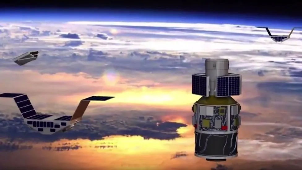
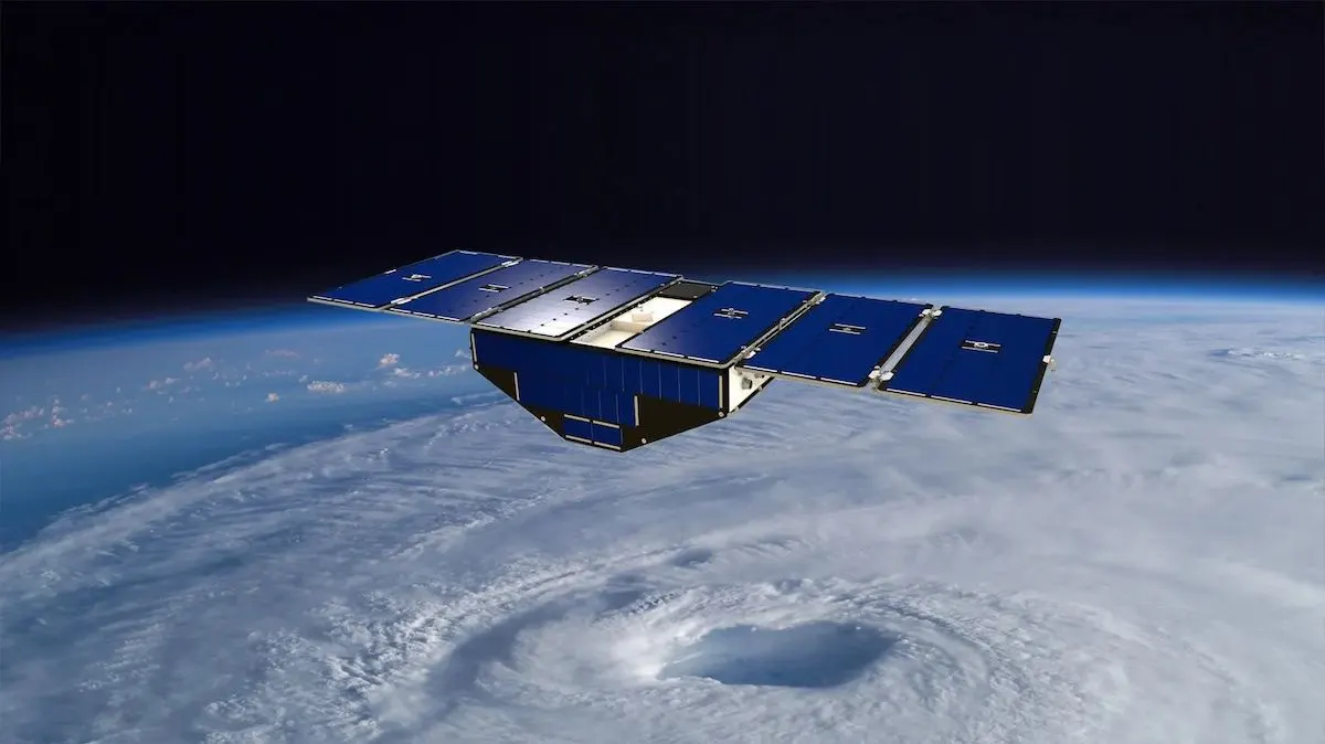
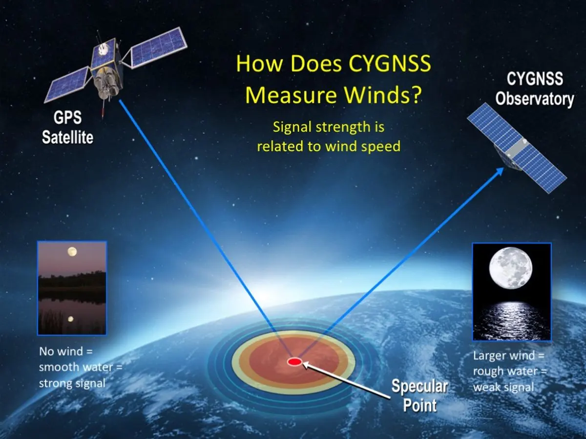
By relying on existing GPS signals rather than generating their own, CYGNSS satellites could be smaller, lighter, and less expensive than many traditional Earth-observing spacecraft. The mission’s constellation of small satellites demonstrated that distributed, cost-effective space systems could produce valuable scientific data — and be adapted far beyond the mission’s original focus.
Built for hurricanes, expanded for Earth science
CYGNSS began with hurricanes, but researchers soon saw that GPS reflections could reveal much more than wind over water.
The same measurement technique could be used over land to detect changes in soil moisture, monitor vegetation, and observe surface conditions relevant to agriculture, climate science, flood prediction, and ecosystem health. Researchers also began exploring how reflected signals might help identify changes in inland water bodies, including indicators of water quality and pollution.
That adaptability is part of what makes the technology so significant. A satellite system designed for one urgent environmental challenge became a platform for many others.
From storm science to wildfire response
The next chapter of this work is already underway.
Michigan researchers and SPRL are helping extend Earth-observation technology into new applications, including wildfire monitoring. As wildfires grow more frequent and destructive in many parts of the world, rapid detection and real-time tracking have become increasingly important for emergency response, public safety, and environmental protection.
New fire-monitoring satellite efforts aim to transform how quickly fires can be identified and monitored from space. Instead of relying solely on ground reports, aircraft, or satellites that may pass over an area only occasionally, emerging systems seek to provide more frequent updates that can support faster decisions by firefighters, emergency managers, and communities.
For Michigan, this work reflects the same pattern that defined CYGNSS: take a breakthrough idea, test it through engineering excellence, and scale it into a tool that can help address urgent global challenges.
SPRL as a collaborative engine
The Space Physics Research Laboratory has been central to Michigan’s space science and engineering work for decades. Housed within Michigan Engineering, SPRL brings together faculty, researchers, engineers, students, and mission partners to design and deliver technologies for space-based science.
Its role is both technical and collaborative. SPRL helps transform scientific questions into instruments, spacecraft systems, and operational missions. It also gives students hands-on experience on projects that reach orbit — connecting education, research, and public impact in a distinctly Michigan way.
CYGNSS is a strong example of that ecosystem in action. The mission required expertise across engineering, climate and space sciences, data analysis, satellite operations, and federal partnership. Its success depended not only on a novel idea but on the ability to build, test, launch, and operate technology that could deliver reliable measurements in space.
Recognition with real-world meaning
The inclusion of a CYGNSS satellite replica in the National Air and Space Museum underscores the mission’s wider significance.
The new RTX Living in the Space Age Hall is designed to show how space technology has reshaped life on Earth. CYGNSS fits that story because its impact extends beyond scientific discovery. Its measurement approach has influenced how researchers, agencies, and companies think about satellite design, environmental monitoring, and the use of space-based data for public benefit.
Why it matters
Climate and environmental challenges are increasingly complex, fast-moving, and interconnected. Communities need better tools to understand what is happening on Earth — from storms and droughts to fires, floods, vegetation stress, and water quality.
CYGNSS shows how university research can help meet that need.
A mission built to look inside hurricanes helped open new ways to monitor the planet. A technology designed for ocean winds is now part of a larger story about soil, vegetation, water, and fire. And a U‑M research effort has become a model for how universities can move ideas from the lab, to orbit, to national recognition — and ultimately to tools that help protect people and the planet.
For Michigan, the throughline is clear: build boldly, adapt creatively, and use technology in service of the public good.